Digital Twin - Digitisation of Maps
The University of Applied Sciences Potsdam (FHP) and the Technical University of Kenya (TU-K) are developing an open workflow for the digitisation of historical maps from the holdings of the Kenya National Archives and Documentation Services (KNADS).

Overview
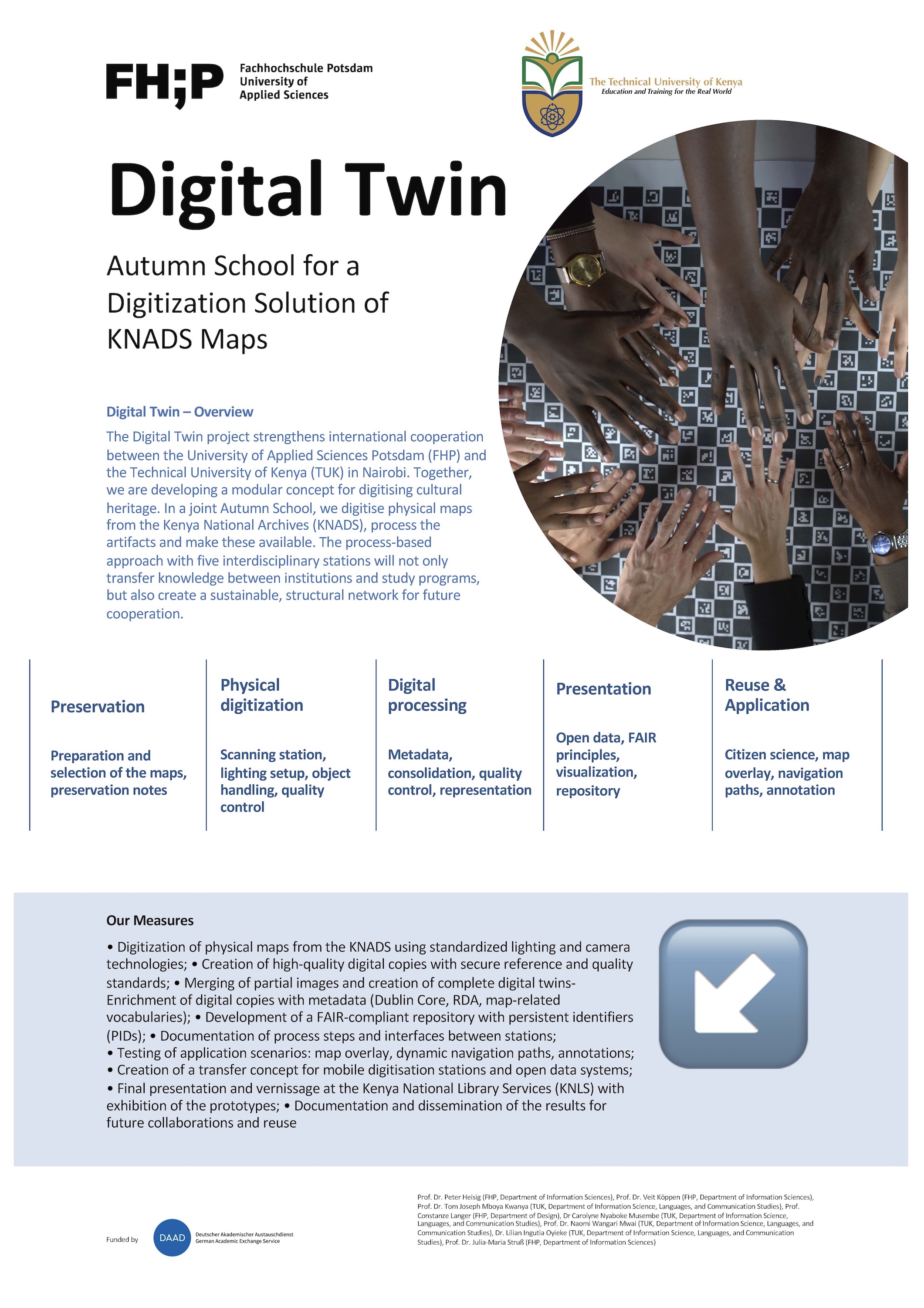
The "Digital Twin" project strengthens the international cooperation between the University of Applied Sciences Potsdam and the Technical University of Kenya in Nairobi. A modular concept for the digitisation of geographical maps was developed jointly. As part of a joint Autumn School, historical maps from the holdings of the Kenya National Archives and Documentation Services were digitised, the digitised data processed and enriched and the necessary steps for making them publicly accessible identified and discussed. The process-oriented approach with several digitisation tools not only enables the transfer of knowledge between institutions and study programmes, but also lays the foundation for a sustainable, structured network between the University of Applied Sciences Potsdam and the Technical University of Kenya as a basis for future cooperation.
Goals
The aim of the project was to develop a workflow for the digitisation and preservation of historical map material. To this end, a reproducible process was developed that combines technical, archival and organisational requirements. At the same time, the project serves as a platform for the international exchange of methods, technologies and expertise, thus creating the basis for long-term cooperation with a focus on the digitisation of cultural assets.
Results
Physical preparation and quality-assured digitisation
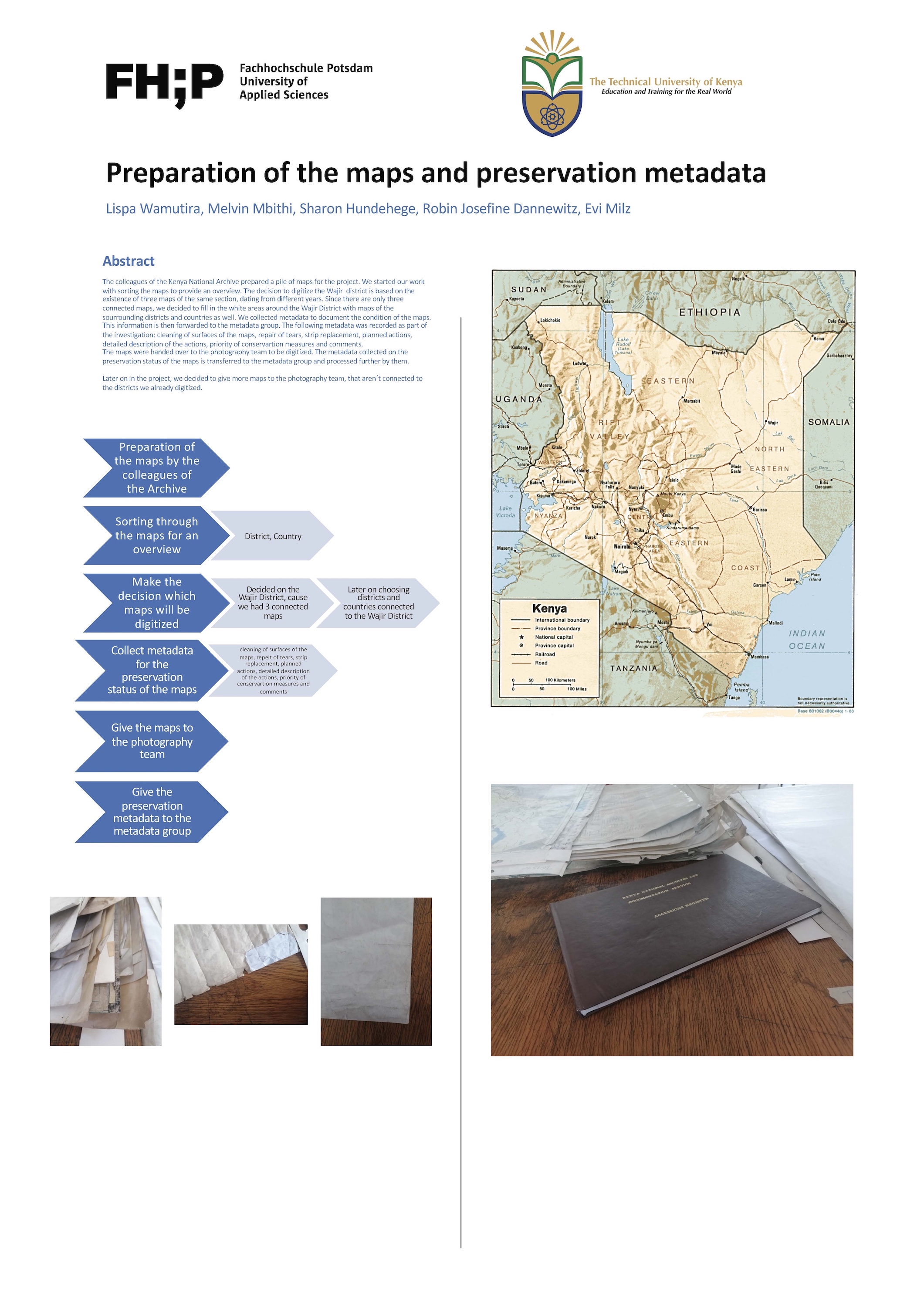
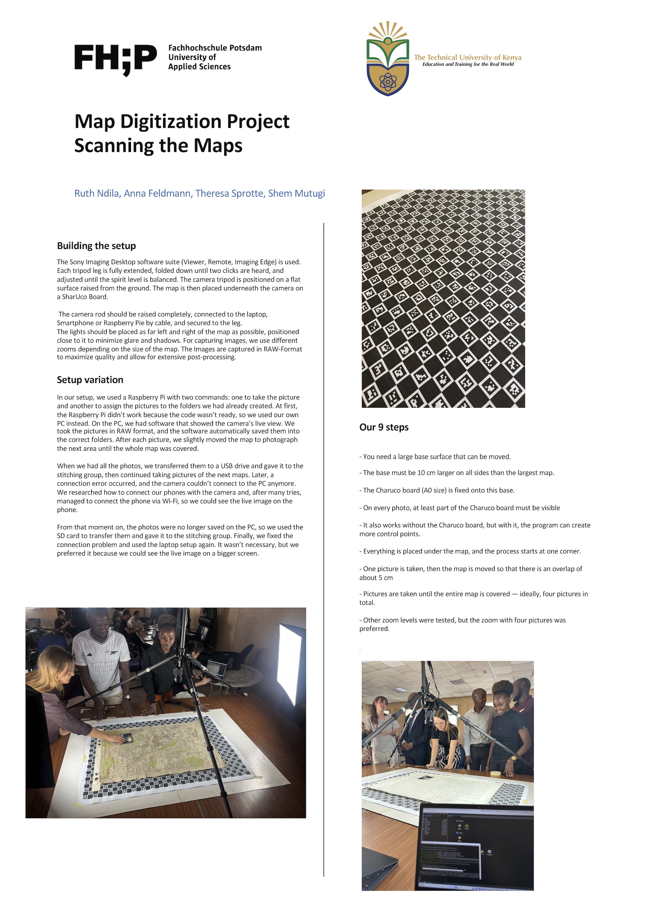
Historical maps from the holdings of the Kenya National Archives and Documentation Services were viewed, selected and prepared for conservation. Preservation conditions, cleaning and repair measures as well as planned conservation steps were documented as preservation metadata. This was followed by photographic digitisation with a standardised camera and lighting setup and systematic quality control. High-resolution digital reproductions were created from the photographs. For storage reasons, JPEG2000 files were used as master files instead of the originally planned TIFF files and integrated into the SIPs as backup digital copies. The resulting composite maps are quality-assured digital representations.
Structured digitisation and processing workflow
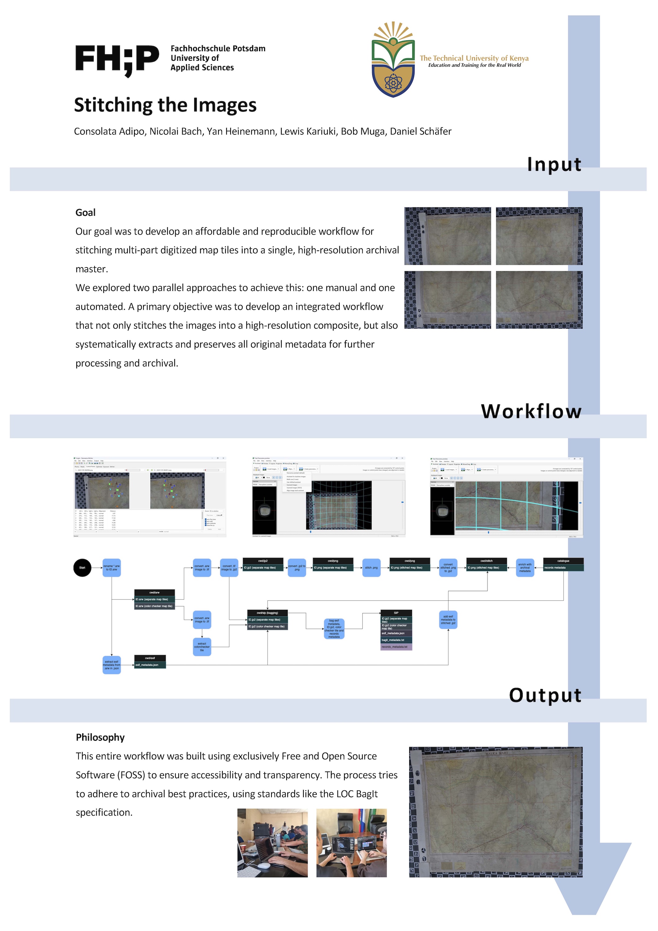
A consistent and reproducible workflow was developed that covers all steps from the photographic capture of the maps to the processing of the RAW files and the creation of quality-assured utilisation derivatives. Complete maps were assembled from segmented RAW images; the integrated process combines manual and automated procedures, organises stitching, secures technical metadata and ensures systematic quality control. The workflow is based on Free and Open Source Software (FOSS) and follows archival best practices, including the LOC-BagIt specification, to enable transferability to other archives and projects.
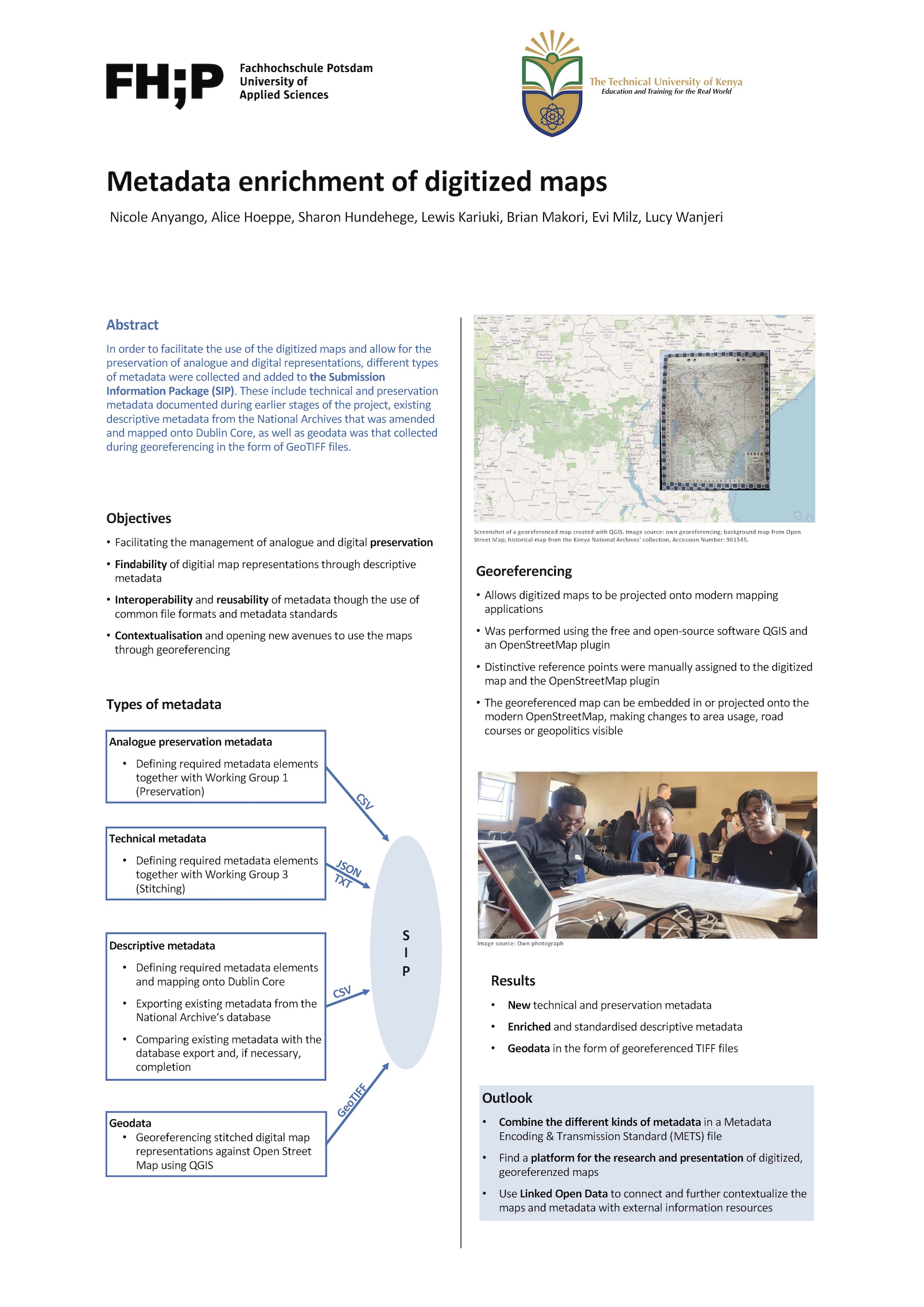
Metadata set and georeferencing for research and use
Various types of metadata were brought together for digital usability. Technical and conservation metadata from the previous process steps were supplemented with the existing descriptive metadata from the archive database and mapped to Dublin Core (including map-specific vocabularies). In addition, the maps were georeferenced in QGIS using an OpenStreetMap plugin and made available as GeoTIFF as a basis for comparison, contextualisation and analysis (e.g. changes in use, road routes or geopolitical boundaries).
Open provision, fair principles and knowledge and technology transfer
Structured data repositories were developed and organisational concepts in line with the FAIR principles were taken into account with a view to the sustainable preservation and open provision of digital maps. Questions of repository structure, persistent identifiers (PIDs) and possible interfaces between the process stations were addressed and conceptually prepared within the project context. At the same time, application scenarios such as map overlay procedures, navigation paths and annotations were tested as examples. Processes, methods and results were documented within the project and presented at the National Museum of Kenya. The structures developed in the project serve as a basis for further development in future projects.


